Showing results 1-10 of 30

Sort results
Sort results
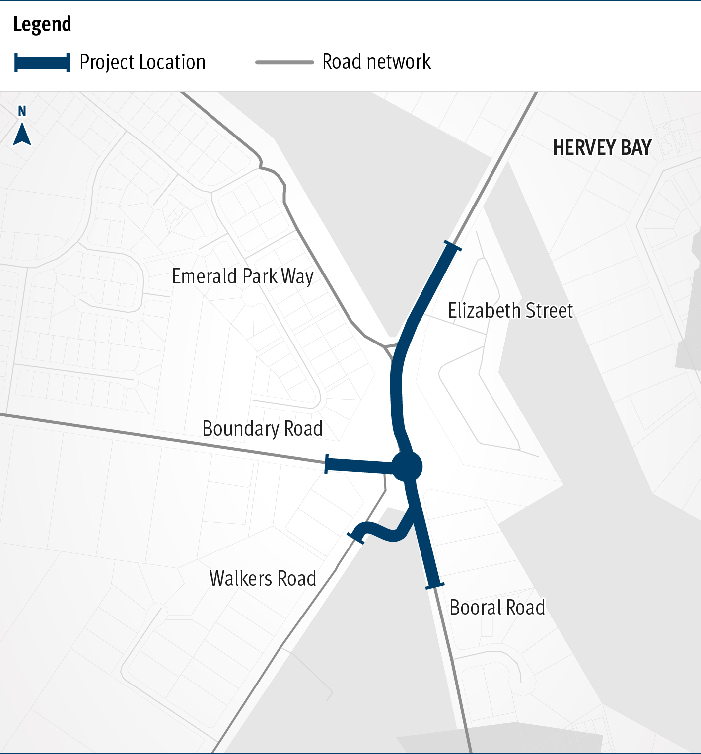
  1. Booral Road and Boundary Road (Urangan), intersection upgrade

    Detailed design is underway for a proposed upgrade of the Booral Road and Boundary Road intersection...

    The map shows the locality of the proposed Booral Road and Boundary Road intersection upgrade. Hervey Bay is located north-east of the project location. A solid blue line indicates the project extent, which encompasses the Booral Road and Boundary Road intersection, and also extends along Booral Road to the north past the Emerald Park Way intersection and to the south along Booral Road past the proposed new Walkers Road intersection. Walkers Road has been realigned to access Booral Road to the south of the Booral Road and Boundary Road intersection. The local road network, including where Booral Road turns into Elizabeth Street, is also highlighted on the map.
  2. Proserpine – Shute Harbour Road, Hamilton Plains, flood immunity upgrade

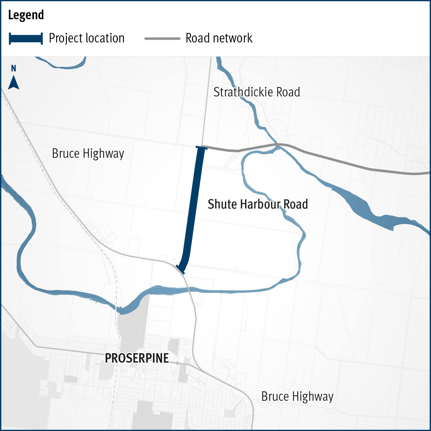
    Proserpine – Shute Harbour Road will benefit from a $21 million flood immunity upgrade at Hamilton Plains between the Bruce Highway turn-off and Strathdickie Road...

  3. Caboolture-Bribie Island Road, Old Toorbul Point Road to Saint Road

    The Queensland Government is finalising planning for the duplication of Caboolture-Bribie Island Road between Old Toorbul Point Road and Saint Road, including signalisation of the Volz Road...

    Side of Old Toorbul Point Road
  4. Coomera Connector Stage 1 South

    Coomera Connector (Stage 1) is around 16km and will be delivered in 3 construction packages. Stage 1 South, currently in the design phase, is the section from Smith Street Motorway to Nerang-...

    No image supplied
  5. Cunningham Highway (Ipswich – Warwick), Tregony to Maryvale, improve safety and Cunningham Highway (Ipswich – Warwick), various locations, improve safety

    The design project is investigating safety improvements for a four-kilometre section of the Cunningham Highway between Tregony and Maryvale...

    No image supplied
  6. Maryborough - Hervey Bay Road and Pialba - Burrum Heads Road, upgrade intersection

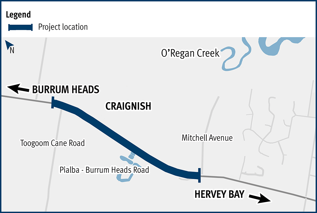
    The Department of Transport and Main Roads is undertaking detailed design for an upgrade of the Maryborough-Hervey Bay Road and Pialba-Burrum Heads Road intersection in Eli Waters...

    No image supplied
  7. Pialba–Burrum Heads Road, O’Regan Creek, upgrade existing floodway

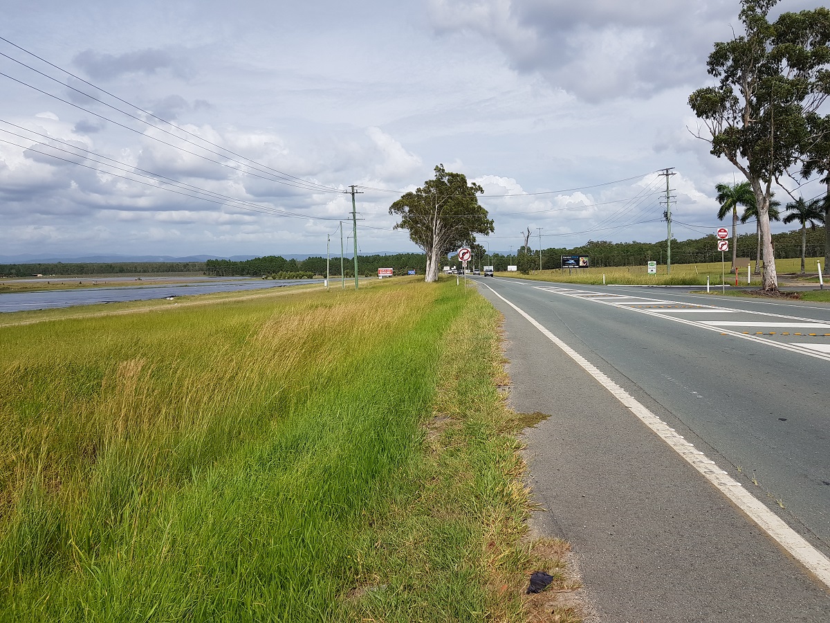
    This project aims to improve the flood immunity and reduce flood closure times at the Pialba–Burrum Heads Road crossing...

    Pialba–Burrum Heads Road, O’Regan Creek, upgrade existing floodway project location map
  8. Linkfield Road Overpass upgrade

    We are undertaking planning for the Linkfield Road Interchange Upgrade in Bald Hills...

    No image supplied
  9. Glass House Mountains Road (Steve Irwin Way) and Caloundra Street intersection upgrade

    New signalised intersection upgrade on Steve Irwin Way at Caloundra Street, Landsborough...

    No image supplied
  10. Coomera Connector Stage 1 Central

    Coomera Connector (Stage 1) is around 16km long and will be delivered in 3 construction packages. Stage 1 Central, which is currently in the design phase, is the 8km section from Helensvale Road to...

    No image supplied
Previous Page (disabled)
  1. Page 1
  2. Page 2
  3. Page 3