Showing results 1-10 of 21

Sort results
Sort results
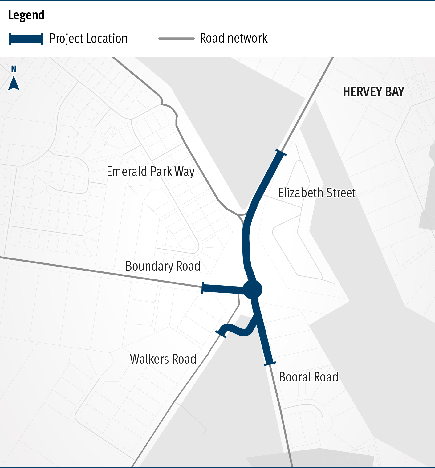
  1. Booral Road and Boundary Road (Urangan), intersection upgrade

    Detailed design is underway for a proposed upgrade of the Booral Road and Boundary Road intersection...

    The map shows the locality of the proposed Booral Road and Boundary Road intersection upgrade. Hervey Bay is located north-east of the project location. A solid blue line indicates the project extent, which encompasses the Booral Road and Boundary Road intersection, and also extends along Booral Road to the north past the Emerald Park Way intersection and to the south along Booral Road past the proposed new Walkers Road intersection. Walkers Road has been realigned to access Booral Road to the south of the Booral Road and Boundary Road intersection. The local road network, including where Booral Road turns into Elizabeth Street, is also highlighted on the map.
  2. Maryborough - Hervey Bay Road and Pialba - Burrum Heads Road, upgrade intersection

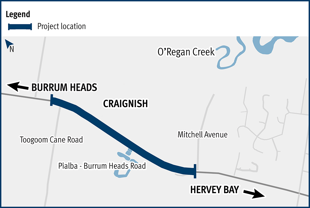
    The Department of Transport and Main Roads is undertaking detailed design for an upgrade of the Maryborough-Hervey Bay Road and Pialba-Burrum Heads Road intersection in Eli Waters...

    No image supplied
  3. Torbanlea manufacturing facility

    We are expected to start construction of the Queensland Train Manufacturing Program manufacturing facility in 2023...

    Aerial image of Torbanlea site location, dense forestry with road traveling through.
  4. Pialba–Burrum Heads Road, O’Regan Creek, upgrade existing floodway

    This project aims to improve the flood immunity and reduce flood closure times at the Pialba–Burrum Heads Road crossing...

    Pialba–Burrum Heads Road, O’Regan Creek, upgrade existing floodway project location map
  5. Natural Disaster Program

    We are reconnecting communities and supporting regional economic recovery after disaster events damaged the state-controlled road network in 2020, 2021 and 2022...

    Aerial view of Alice River Bridge (completed)
  6. Bruce Highway (Cooroy to Curra) Section D

    The $1 billion Section D: Woondum to Curra (C2CD) project is a new 26km, 4-lane divided highway between the existing Bruce Highway interchange at Woondum, south of Gympie and Curra...

    Deep Creek bridges looking south west
  7. Mundubbera – Durong Road, John Peterson Bridge (Boyne River), replace bridge

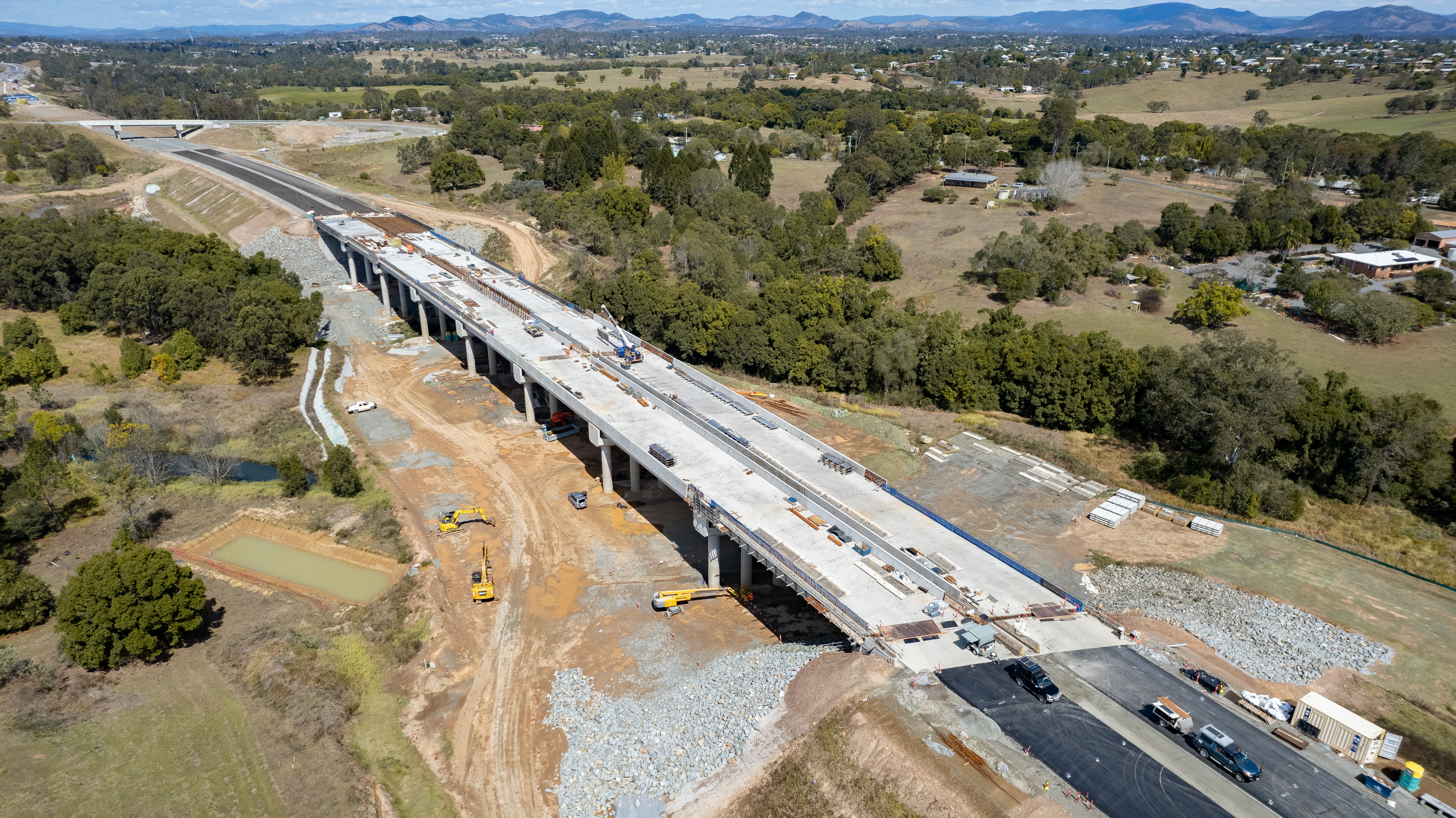
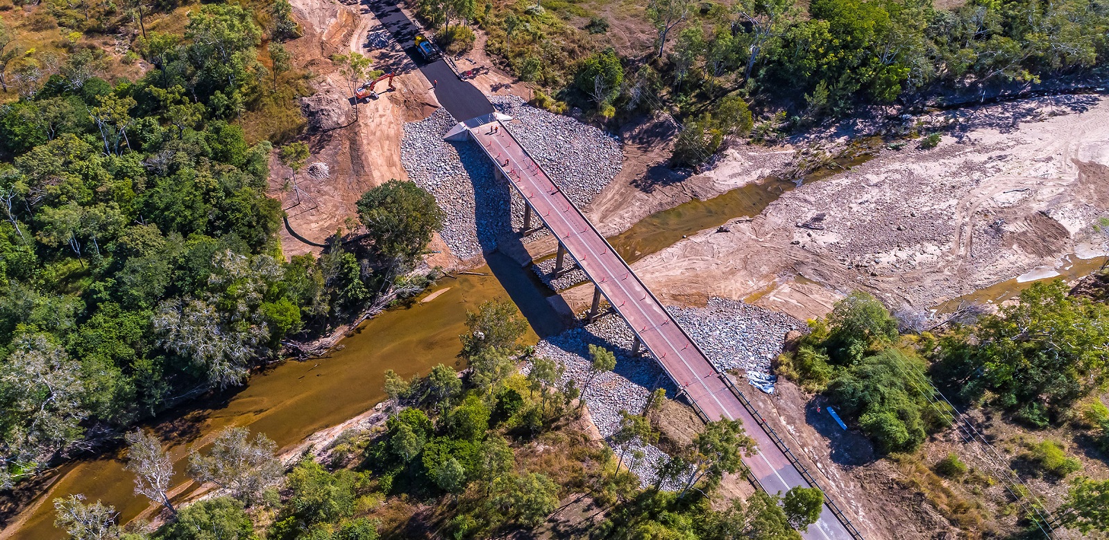
    The single-lane John Peterson Bridge will be replaced with a higher, safer, more flood-resistant 2-lane structure on an improved alignment...

    No image supplied
  8. Booral Road, Bunya Creek floodway and Main Street intersection upgrade, planning

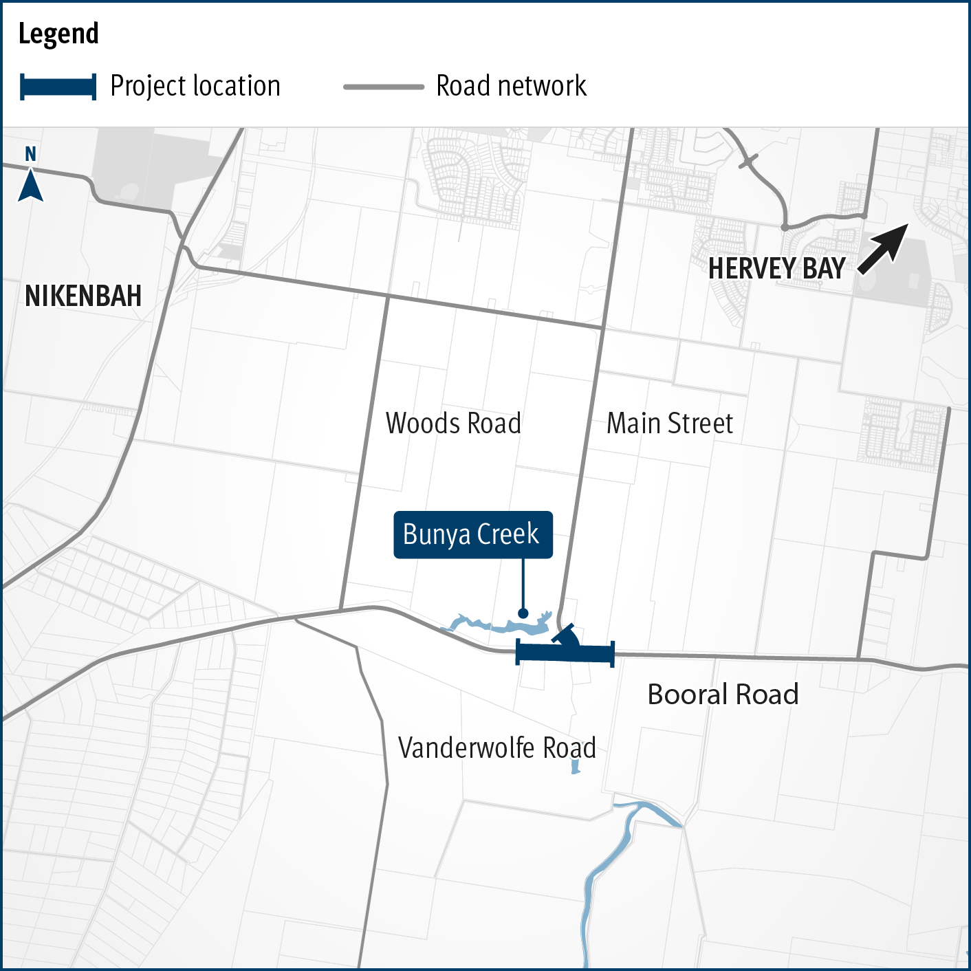
    Planning is underway to improve flood immunity and safety on a section of Booral Road at Bunya Creek, including the Main Street intersection...

    Alternative text: The map shows the locality of the proposed Booral Road, Bunya Creek floodway and Main Street intersection upgrade. Nikenbah is located to the north and Hervey Bay to the north-east. Bunya Creek is located just north west of the proposed project location. A solid dark blue line indicates the project extent, which encompasses the Booral Road and Main Street intersection as well as the Bunya Creek floodway along Booral Road, which is located just west of the intersection. The local road network, including Woods Road and Vanderwolfe Road are also highlighted on the map.
  9. Torbanlea – Pialba Road, various locations, upgrade intersections and floodways

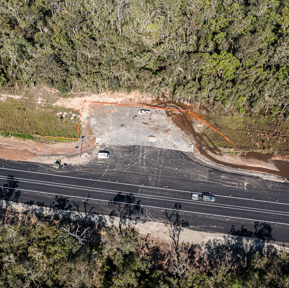
    Construction has started on flood immunity and road safety upgrades on Torbanlea – Pialba Road between Beelbi Creek and Takura...

    No image supplied
  10. Monto - Mount Perry Road progressive sealing

    A combined funding amount of $16 million has been allocated under the Australian Government's Road Safety Program and the State Road Network Upgrades investment program to progressively seal sections...

    No image supplied
Previous Page (disabled)
  1. Page 1
  2. Page 2
  3. Page 3